
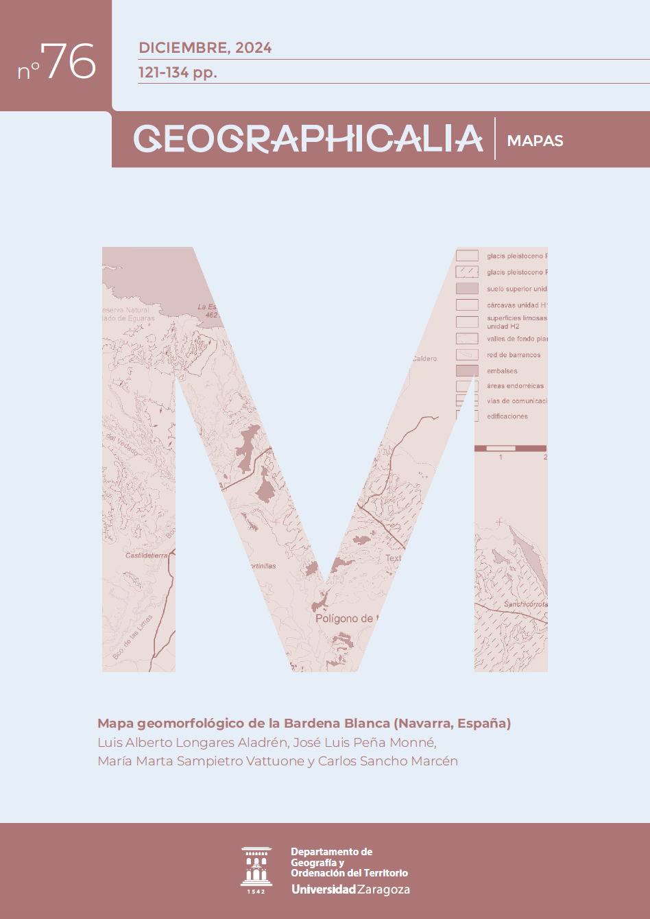
Geomorphological map of the Bardena Blanca (Navarra, Spain)
SPECIAL ISSUE ON GEOMORPHOLOGY
DOI:
https://doi.org/10.26754/ojs_geoph/geoph.20247611066Keywords:
Geomorphology, Quaternary, Cartography, semiarid area, Ebro BasinAbstract
The geomorphological map of Bardena Blanca has been prepared from field and cartographic information collected throughout numerous research projects on the geomorphology of Las Bardenas Reales. The main objective is the graphic representation of the morphologies present in the area, classified and ordered chronologically following a standardized legend developed for detailed maps. The map provides morphogenetic and chronostratigraphic data of the Late Pleistocene and Holocene deposits along with their evolutionary interpretation. Knowledge of the influence of climate changes on the geomorphological dynamics of the Bardena Blanca during the Holecene is of great importance to predict regional evolution in the scenario of future climate changes
Display downloads
Downloads
Additional Files
Published
Issue
Section
License
Copyright (c) 2024 Geographicalia

This work is licensed under a Creative Commons Attribution-NonCommercial-NoDerivatives 4.0 International License.
- La revista conserva los derechos patrimoniales (copyright) de las obras publicadas, y favorece y permite la reutilización de las mismas bajo la licencia indicada en el punto 2.
- Las obras se publican en la edición electrónica de la revista bajo una licencia Creative Commons Reconocimiento-NoComercial-SinObraDerivada 3.0 España (texto legal). Se pueden copiar, usar, difundir, transmitir y exponer públicamente, siempre que se cite la autoría, la url, y la revista, y no se usen para fines comerciales.
- Los autores están de acuerdo con la licencia de uso utilizada por la revista, con las condiciones de autoarchivo y con la política de acceso abierto.
How to Cite
Accepted 2024-12-11
Published 2024-12-30

